| Schooner Ernestina traveled yesterday and
through last night after leaving the protected
anchorage in Haverstraw Bay in the Hudson River.
The East Wind blows in moisture off the Atlantic
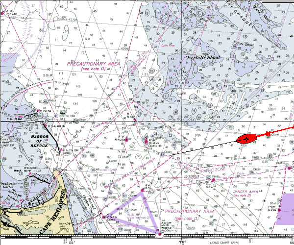
Ocean but also drives the ship along. The chart image today shows the ship
rounding the Overfalls Shoal off Cape May, NJ
with the Traffic Lanes just to the south. This
area requires some care and an observant crew,
especially in conditions of reduced visibility,
because all the shipping converges here and must
pass nearby Cape Henlopen for transits up into
the Delaware River.
With 'round the clock
operation, the ship runs three watches rotating
responsibilites on a watch schedule. One watch is
up navigating, steering, regularly checking the
boat for anything amiss such improperly belayed
lines or any waste of finite resources such as
lights on unnecessarily or water faucets running.
Others sleep.
After a seasick night for some,
spirits rebound fast as the ship turns off the
wind into Delaware Bay.
Wind: E Force 4
Visibility: poor in fog and rain
Skies: cloudy with rain
Seas: 3-5 feet, swells
Captain: Willi
Bank
Program Coordinator: Crista Mellican
|