         |
Ernestina
Logbook Page
Date: Thursday,
June 15, 2000
Time: Evening
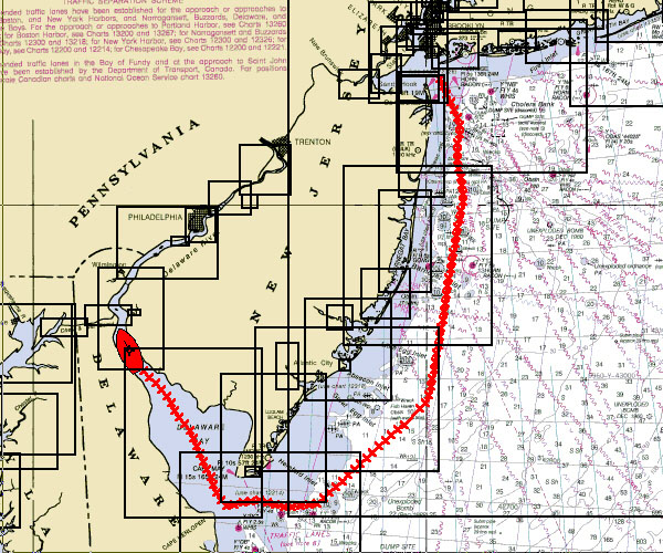
| Schooner Ernestina sailed most of the
trip from the Hudson River to the Delaware under
sail. The chart shows the overall track covering
almost two hundred miles. Although it is a long
distance along the coast, there are few
anchorages that can handle Ernestina's draft (or
depth in the water) of 13'. The ship can come
into Sandy Hook on the northern end of the New
Jersey Coast, Atlantic City and Cape Henlopen in
Delaware. Much of the transit into Delaware Bay
is in a narrow channel with too little water on
either side to anchor. The
ship is at anchor where the river begins to
narrow but the average depth from bank to bank
increases.
Wind:
Visibility: Improving
Captain: Willi
Bank
Program Coordinator: Crista Mellican
|
 |
 |
We would like to thank Lotus and IBM
for donation of software, hardware and
funding to enable regular electronic updates
from the ship.
NOAA Chart
is provided courtesy of Maptech using
Cruising Navigator 4.3 and grabbing the image
using Grabit Pro 6.02.
|
 |
|
