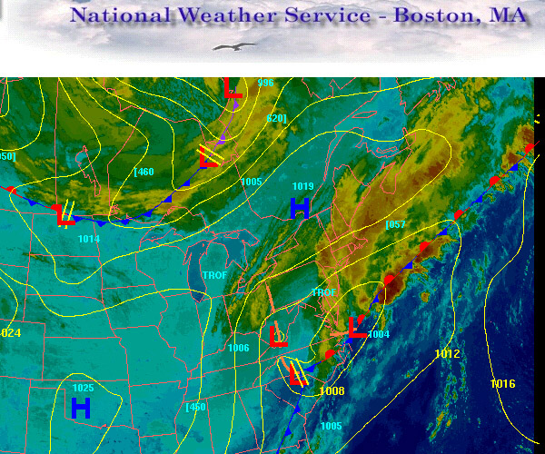
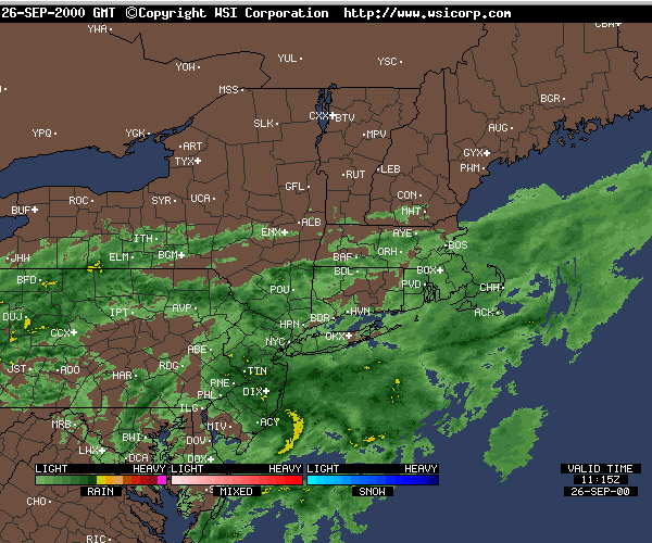
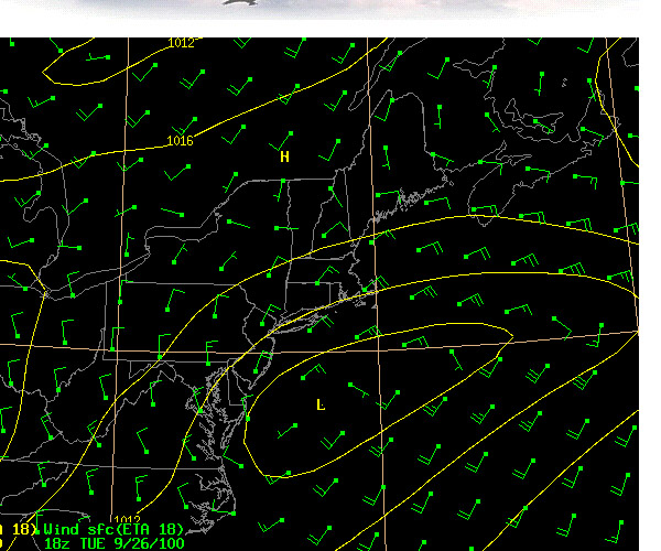
| As you can see from the images, a low
pressure center is coalescing off the Carolina
Coast (Cape Hatteras is known for this) and
moving NE generating up to gale force winds from
the NE ahead of it. The
second chart shows the precipitation generated at
this time and finally, the surface winds and
isobars around the low pressure system.
We can see that the winds will
soon diminish for a transit to New Bedford
tomorrow.
The National Weather Service
Forecast follows:
National
Weather Service Taunton MA
315 AM EDT Tue Sep 26 2000
From the Merrimack river MA to Watch Hill RI, out
to 25 NM
Synopsis-
315 AM EDT Tue Sep 26 2000
Synopsis:
Low pres along the North Carolina coast this
morning will move north-Eastward today and
intensify into a gale center. The low will pass
about 150 NM SE of Nantucket early this evening.
It will continue north-Eastward to E of Nova
Scotia Wed. Weak high pres will build S of the
Southern New England waters Wed, while a cold
front approaches from the NW late Wed.
Cape
Cod Bay-
Coastal waters from Merrimack river MA to Chatham
MA, Out to 25 NM-
315 AM EDT Tue Sep 26 2000
Small
craft advisory
Today:
NE Wind increasing to 20 to 30 kts. Seas
building to 4 to 8 Ft. Vsby 1 to 3 miles in rain
and fog.
Tonight: NE Wind 20 to 25 kts shifting to N
and diminishing to 10 to 15 kts around midnight.
Seas 3 to 6 Ft. Vsby 1 to 3 miles in rain and fog
early.
Wed: NW Wind 10 to 15 kts shifting to W. Seas
2 to 4 Ft.
Captain: Sophie
Morse
Program Coordinator: Crista Mellican
|


