| What a beautiful day for a sail! The
weather report calls for fair skies and a brisk
SW wind building in the afternoon. By the time we
get to the Cape Cod Canal the tide will just have
turned in our favor. So, although we have 80
miles or more to cover today, we have everything
going in our favor. Today has been one
of those idyllic days onboard the Schooner
Ernestina. 22 6th graders and 6
chaperones from the Charles River School boarded
this morning around 0830 for a 12-hour transit to
Boston. We circled around the wheel for
introductions, and each person named one item
they’d bring on a trans-Atlantic voyage to
Cape Verde—an item that starts with the same
letter as the person’s first name! Once we
felt we’d be well-equipped with such
creative and sensibly-minded participants, we
were ready to get underway!
The Charles River School has
sailed aboard Schooner Ernestina for several
years now during this unpredictable month of
October. They have pulled with a will through
rain and wind. Every year in the past they've had
less than ideal weather (to put it mildly) and
are due for a great day like this!
After an orientation and safety
discussion for all hands, Ernestina backed out
from her berth at Tonnessen Park on New Bedford
State Pier, past the fishing vessels tied up at
Fisherman's Wharf, and all hands set to work
setting the "four lowers" in the brisk
southwesterly breeze. Since we had a long way to
go, we kept the motor turning over as we steamed
out through the entrance channel to New
Bedford/Fairhaven Harbor. By the time we reached
Butlers Flat Lighthouse we had the mains'l and
fores'l set. Soon thereafter we were under sail
alone moving along with Ernestina easily making
nine knots on a broad reach across Buzzards Bay
toward Naushon Island.
Sail maneuvers wove intermittently in with our
classes throughout the day. The students were
divided into watch groups first thing, and their
brief watch orientations before we got off the
dock were enough to get them rolling. At about
1030, after a snack break to rejuvenate after all
that sail-raising, "A"-watch took the
deck and got opportunities to steer, navigate,
stand bow lookout, run boat checks, and help with
basic sail maneuvers. Morning classes for
"B" and "C" watches focused
on weather observations (with Jay) and the simple
machines we use to gain mechanical advantage
onboard (with Jim).
After tacking to a port tack on
the other side of the Bay, we sailed in on
Cleveland Ledge Light to enter the Cape Cod Canal
approaches. The wind was building at the head of
Buzzards Bay as typical for a strong SW'ly
breeze. We decided to strike the jib, turn into
the wind under power and strike the mains'l and
then fall off again to go under fores'l and jumbo
along with the engine through the Cape Cod Canal.
The Army Corps of Engineers
maintains and operates the Canal and has strict
requirements for the many ships that pass
through. We are required to call "Canal
Control" on the VHF radio to describe our
intentions, the type of ship we operate and how
many passengers aboard, etc. We also are not
allowed to sail through the Canal and must have
the engine turning over.
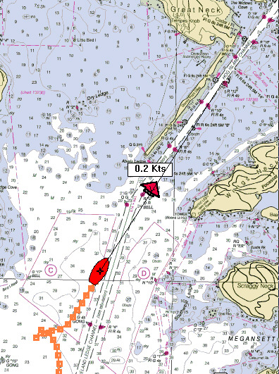
You can see from the images
that we had fair current of 2.3 knots or more
which made our speed close to 11 knots over the
ground at times thanks to the combination of
current, engine, the sails and fair breeze. It
took no time at all to pass the seven or eight
miles into Cape Cod Bay.
Not long after we threaded up into the Canal,
the lunch bell rang, and grilled cheese
sandwiches with tomato soup filled up everyone’s
attention and bellies. Students and teachers held
up a "CHARLES RIVER SCHOOL" banner for
a pair of waving, photographing parents strolling
the bikepath on the mainland side of the Canal,
and we all waved. As that following tide pushed
us out the northern end of the canal, students
were engrossed in asking questions and listening
to crewmembers Gwen and Rob talk about life
aboard schooners. Their attentions were only
interrupted for re-setting the jib; a few
students climbed out on the bowsprit to help
untie it (unfurl the sail).
Southwesterly breezes pushed us gently up
Massachusetts Bay; under the three forward lowers
we were running in good time to make Boston by
evening. In afternoon classes , students with
Eric focused on chart use in navigation and with
MaryHelen on ocean topography and how captains
found their way across miles of open ocean before
the advent of Radar, Global Positioning Systems,
and other modern navigational aids.
Just before and as "C" watch took
the deck at 1600, several students harnessed up
with MaryHelen’s help and got their wish of
climbing out on the bowsprit, just to feel the
sea rolling DIRECTLY beneath their feet. Others
focused on food webs in the ocean with Kristen,
and then all the off-watch students helped to set
and haul back our large neuston (surface-layer)
plankton net. Because we were making such quick
headway up the Bay, we had to wait for a
container ship to pass so we could head up a bit
and slow down so we wouldn’t damage the net!
Everyone got excited to inspect the critters
captured (temporarily) in our sample cup;
microscopes and magnifiers helped students
observe copepods, larval crabs, and other tiny
inhabitants of our surface waters before
releasing them back to the sea. After the last
few students took their turn on the bowsprit, it
was dinnertime, and we all dug in to saucy
chicken with rice and salad. All that bright
sunshine and fresh air can really make you
hungry!
Just at sunset we approached
the entrance to Boston Harbor. We passed among
the Harbor Islands through "The
Narrows" past Georges, Lovell and Gallops
Islands to enter the Inner Harbor. It was a
beautiful sight to see the lighted skyline of the
city from the sea.
After dinner, all participants huddled below
in the Fish Hold with Traudi and MaryHelen and
heard (and participated in!) stories from
Ernestina’s illustrious past 108 years. By
the time we came back up on deck, we were docking
at Boston Harbor’s Fan Pier. With string and
a marble in each pocket, and a brief introduction
to the art of making Monkey’s Fists, the
Charles River School were off to climb aboard the
bus for home. After 80.2 nautical miles of
sailing in some of the greatest weather we’ve
enjoyed all season, they deserved to be tired and
happy from such a full day.
Great job to the Pam Moore and
the students and chaperones from the Charles
River School! We covered a lot of water in the
past twelve hours and look forward to sailing
with Charles River School again soon!
Program Coordinator: MaryHelen
Gunn
Captain: Gregg Swanzey
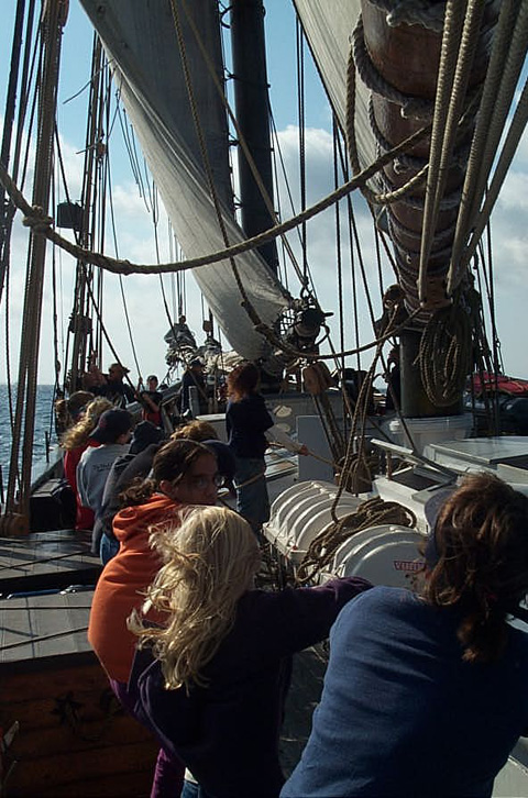
The fores'l is going up. Jumbo
and jib yet to go!
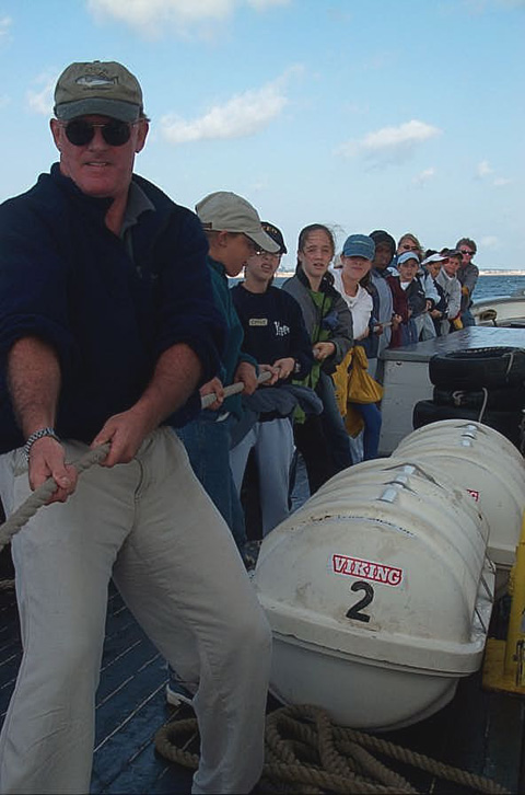
It takes everyone aboard to set
the mains'l and fores'l!
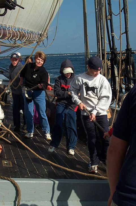
Hauling away to set the
fores'l.
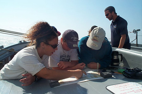
Navigation is a constant
responsibility for the watch on deck. Here chief
mate Erica Sachs works with students to fix the
ship's position as we approach the entrance to
the Cape Cod Canal. The mains'l is still up (you
can see the sheet in the background) but will
soon come down before entering the narrow channel
to the Canal.
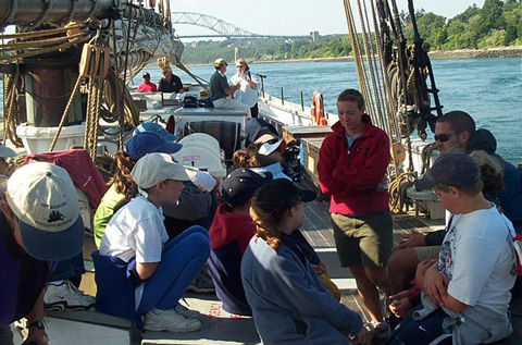
Small group discussions were
happening all day. Here the Bourne Bridge
disappears behind the ship as we steam through
the Cape Cod Canal.
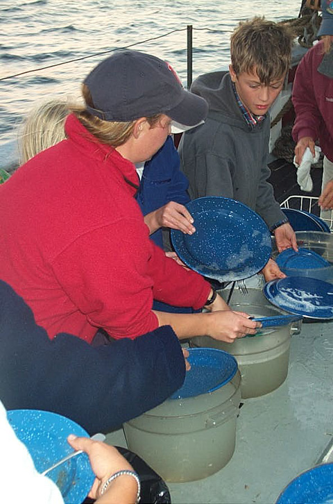
Meals took place on deck with
everyone chipping in on the dishes at the end.
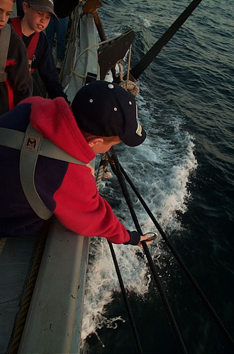
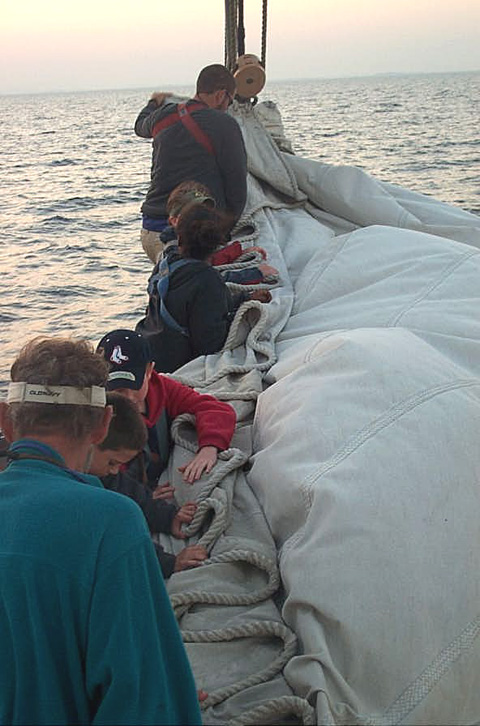
Clipping in before heading out to help furl
the jib.
|
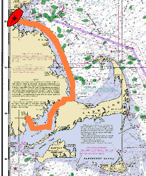 The day's run from New Bedford
State Pier to Boston Fan Pier through the Cape
Cod Canal.
We turned into the wind to strike the mains'l
just befor entering the Canal.
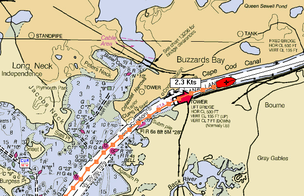
Fair current added 2.3 knots to our speed
through the Canal.
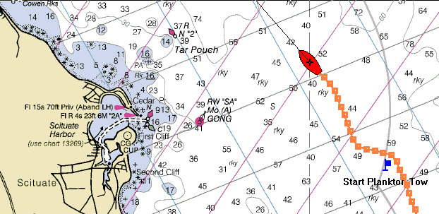
The plankton net went over off Scituate
Harbor.
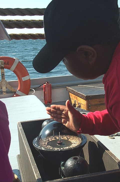
The bearing compass can be used to check the
wind direction or sight landmarks for bearings to
help fix the ship's position.
The plankton tow came aboard with comb jellies
galore!
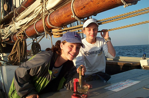
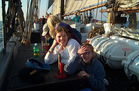
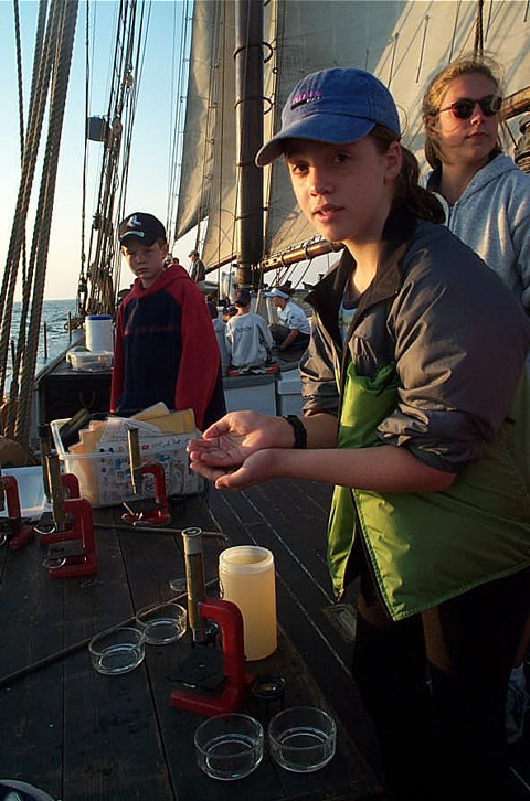
The microscopes are set up to take a closer
look at the plankton.
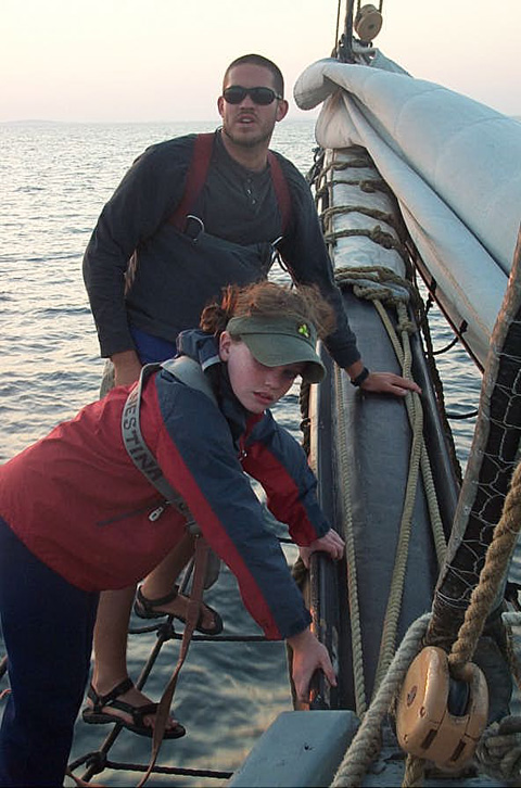
"Laying on" is the call when
stepping onto the footrope. Students lined the
bowsprit all the way out to the end to help furl
the jib after it was "struck."
Out on the bowsprit furling the jib as the sun
sets low in the sky in the west...
|


