|
After
the first group from the Ross School departed, the crew had a
quick meeting and then welcomed the next group onboard.
These classmates of the first group will have a similar
program, but will be onboard for a lengthier 48 hours.
The student boarded and stowed their gear by 1000 and
we were able to get underway almost right away.
Throughout the morning student were oriented to the
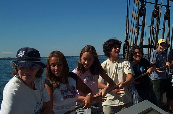
boats and we raised the four lowers before lunch.
While at first the main seemed heavy, the group pulled
together and the remaining sails were hoisted with ease.
During
the afternoon, students began standing watch and went through
a series of learning stations including ship construction and
knot tying. The
watches also studied how people made charts before the modern
equipment of todays sailing world.
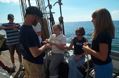
Two of the watches had a chance to build a chart, and
all the students built quadrants for use on anchor watch to
determine our latitude.
Throughout
the afternoon the wind shifted and varied in intensity, but by
1645 we dropping our sails and anchored in Cherry Harbor.
With a clear sky above, we opened the pool with a swim
call. Students
jumped off the bow sprit and a couple (not very successfully)
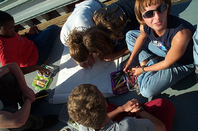
tried some flips. Just
before dinner everyone worked on an art project, doing a
mechanical drawing of something on the Ernestina.
After
an evening program of astronomy and stories, students did some
journaling and hit the hay for a good nights sleep and an
anchor watch. During
anchor watch, students used the quadrants they made during the
day to determine the latitude based on the angle of the North
Star to the horizon. Although
the range was from 30 to 60 degrees, most students came close
to the actual location at 41 degrees.
Captain:
Sophie Morse
Program Coordinator: Gretchen Stuppy
|